What Is the Galileo GNSS?
February 17, 2026
Estimated reading time: 7 minutes
The Galileo global navigation satellite system (GNSS), named for Italian astronomer Galileo Galilei, began operating in Europe in 2016. Owned by the European Union (EU), Galileo is a precise, civilian-controlled, state-of-the-art positioning system.
It works with GPS in the U.S., BeiDou in China and GLONASS in Russia. It also works with regional systems like Japan’s QZSS and India’s IRNSS.
By offering multifrequency GNSS signals as a standard feature, Galileo delivers real-time positioning. It is more precise than other public systems. The satellite system allows users to determine the exact location of their devices. This accuracy supports everyday products and services that rely on navigation.
In May 2002, the former European Community (EC) and the European Space Agency (ESA) created the Galileo Joint Undertaking. This venture oversaw the development of the Galileo global satellite navigation program.
In July 2004, the EC established the European GNSS regulatory body, GSA, as a community agency. The EC tasked the GSA with supervising existing satellite positioning and navigation programs. This included the European Geostationary Navigation Overlay Service (EGNOS) and the Galileo system.
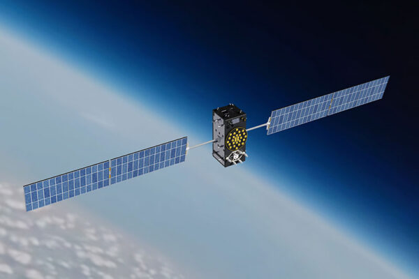
The system reached full operating capability in 2024, with additional replenishment satellites scheduled through 2026. As of early 2026, Galileo operates with 33 satellites, 25 of which are usable for service provision.
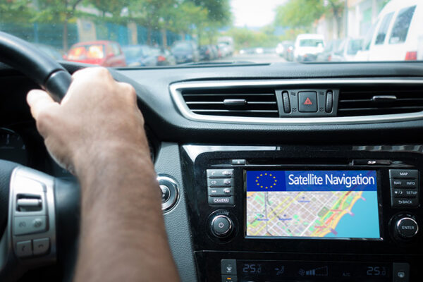
Nearly 4 billion devices worldwide rely on Galileo for navigation. Its signals support consumer products, like in-vehicle navigation systems and mobile devices. They also support public transportation services in Europe.
Galileo was created first for commercial and civilian use. Other systems, such as GPS and GLONASS, originated as military programs, with commercial applications added later.
Galileo provides most of the satellites that broadcast signals in the E1 and E5a frequency bands. It also supports the newer E6 band, strengthening multifrequency, high-precision services. The wider signal is important for navigation in cities, where buildings often block or reflect GNSS signals.
The system operates alongside GPS and other global satellite systems to improve navigation. This shared signal design increases accuracy and resilience. With satellites always “in view,” devices receive more exact and reliable positioning, particularly for dual-frequency and multifrequency navigation.
Each Galileo satellite uses rubidium and passive hydrogen maser clocks to achieve 30-nanosecond timing accuracy. Precise timing supports applications that depend on consistent synchronization, including:
Galileo’s range of GNSS services allows IoT devices to operate with greater reliability and confidence.

OS is free for use in the general IoT and consumer markets. It provides timing and positioning with meter-level precision, further improved to submeter for dual-frequency combinations.
Safety of Life (SoL), initially envisioned as a standalone service, is now deployed within OS. It is available free of charge and not encrypted.
With SoL, applications can leverage an integrity-monitoring feature that warns of signal disruption. If a satellite signal fails or becomes unreliable, the Galileo receiver alerts the application. The device or service provider triggers an alarm or takes appropriate action.
PRS offers higher precision and encrypted access, intended primarily for public safety and civil authorities. Specifically designed to resist jamming and spoofing, it uses E1 and the new E6 signals. Decryption is required to access navigation, positioning or timing data. Providers must obtain national authority approval for testing or development of PRS-compatible devices and applications.
Ground-based emergency beacons use the SAR system to transmit distress signals to passing satellites. Then they relay those alerts to Galileo monitoring centers, which route them to the appropriate authorities or service providers.
Compared to other constellations, Galileo’s SAR service provides lower latency between beacon activation and alert delivery. The service reduces the time to detect emergency distress signals to about 10 minutes. Other constellations may require up to three hours.
Faster detection and more precise location data help emergency teams reach people in trouble at sea. They also help teams reach people in remote areas more quickly.

Launched in 2023, HAS uses the E6-B frequency. It provides free access to positioning data for precise point positioning (PPP) in real time. The service provides free global decimeter-level accuracy and OSNMA verification.
HAS delivers satellite orbit and clock correction data. This enables devices to achieve highly accurate positioning when processed with a PPP algorithm. The service has potential applications across multiple sectors, including:
The rollout of HAS will continue until 2030. More improvements are expected during this time. This is because the ESA will launch Galileo Second Generation (G2) satellites. These enhancements will enable:
Ground stations will undergo upgrades to support G2 satellites.
Operating since July 2025, OSNMA authenticates navigation messages for free. It provides a reliable, globally available defense against spoofing attempts.
Unique to Galileo, the service checks that location data comes from the system and that the signal was not spoofed. Highly relevant to IoT applications, it helps to ensure data security. OSNMA should reach full deployment by 2030.
More services will be offered by Galileo GNSS in the future, including:
Timing Service Message (TSM)
TSM provides free timing and synchronization information.
Signal Authentication Service (SAS)
Galileo SAS supports civil use. It adds verification to OSNMA within the E6 signal range, ensuring security and accuracy for HAS.
Emergency Warning Satellite Service (EWSS)
The Galileo EWSS withstands extreme weather events and will relay emergency alerts to GNSS devices in specific regions. Traditional alert systems rely on cellular signals. By using satellites, EWSS can broadcast messages, such as hurricane or tsunami alerts, to users in remote areas. It will send the warnings straight to Galileo-enabled devices for quick emergency response and risk management.
The G2 satellites are under development. These new satellites will feature six atomic clocks, up from the current four, to provide stable, reliable timing information. They will also feature digital and reconfigurable payloads for unparalleled flexibility.
The first G2 satellites are expected to launch in the coming years. Their 15-year lifespan and ability to adapt to changing user needs will keep services running into the 2040s.
Galileo-based geopositioning is reshaping how connected products are designed and deployed. The system’s capabilities include:
These enhancements allow developers to rethink product roadmaps and accelerate innovation across sectors like:
Telit Cinterion’s comprehensive GNSS portfolio is designed for IoT and high-performance positioning. We offer leading positioning and timing modules that support a wide range of IoT applications.
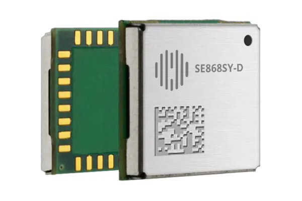
The SE868SY-D module delivers strong performance in dense urban environments. It supports refresh rates up to 25 Hz to ensure responsive, reliable navigation data.
Our SE868K5 series builds on that foundation and uses the same form factor for unmatched flexibility. Modules SE868K5-I and SE868K5-RTK are also Galileo-enabled. They support multi-constellation and multifrequency positioning. Using real-time kinematic (RTK) positioning, the RTK variant can deliver centimeter-level accuracy.
The SL871K2L series extends the portfolio with low-power, cost-effective solutions.
Across our portfolio, built-in spoofing prevention can be strengthened through Galileo OSNMA. This adds an extra layer of signal verification for sensitive or high-integrity IoT use cases.
Speak with our GNSS IoT experts to find the right module for your next geoposition-enabled IoT project.
Editor’s note: This blog was first published on 14 July 2021 and has since been updated.