Business Advantages of a Multi-GNSS, Multifrequency Setup
August 29, 2024
Estimated reading time: 11 minutes
Global Navigation Satellite Systems (GNSS) are key to Internet of Things (IoT) functionality. They provide critical and precise timing and positioning functions for device operations.
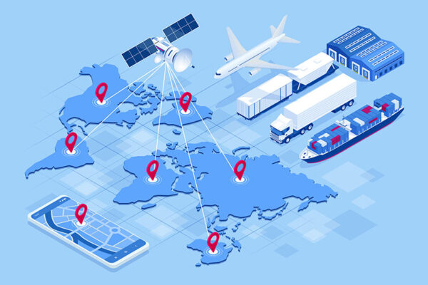
GNSS uses satellite technology to provide insight into connected devices’ geographic locations. An inclusive term for the category of global systems, GNSS encompasses the global-coverage constellations:
GNSS also includes regional constellations like:
Using multiple constellations simultaneously combines those systems’ benefits for improved satellite coverage and performance.
Regional satellite-based augmentation systems (SBAS) assist the global systems:
Another strategy to maximize device geolocation performance is a multifrequency approach. In addition to the traditional L1 band, modern GNSS receivers now support the L5 band (centered at 1176.45 MHz). Using two frequencies allows devices to achieve greater location accuracy and be less affected by jamming or interference. SBAS systems worldwide are also evolving to support multifrequency setups.
As global demand for location-based services increases, businesses can expect to see more integration of GNSS technologies. Which GNSS platforms are available today, and how do they differ?
While GPS and GNSS are often used interchangeably, GPS is the world’s most utilized satellite navigation system. It operates from 32 satellites across six orbital planes.
GPS was first made in the U.S. for military use. It is now used for in-car navigation and business tagging on social media.
Like GPS, GLONASS was designed in the 1970s as Russia’s military positioning system. Commercial uses, such as navigation and weather broadcasts, began in the 1980s with 24 satellites across three orbital planes.
Since 2000, China’s BeiDou Navigation Satellite System (BDS) has been on the rise to overtake GPS in global commercial usage. In its third generation, BeiDou claims to reach a millimeter-level accuracy that outperforms other systems.
Developed by the European Union in 2011, Galileo is a civil constellation (i.e., under civilian control). It’s undergoing several improvements, like the Galileo High Accuracy Service (HAS) that went live for testing in 2023.
It uses 24 satellites in six orbital planes. This setup provides a more accurate positioning service at higher latitudes than other GNSS systems. Galileo is providing emergency response services and making Europe’s roads and railways safe for everyone.
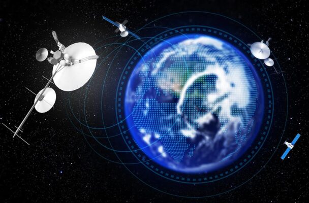
Modern positioning and timing modules have evolved to take advantage of multiple GNSS constellations at once. Combining multiple satellite systems:
Using multiple GNSS systems helps you stay connected and centered, whether in a city or desert, for continuous positioning. Industries and businesses can achieve the following benefits:
If a satellite fails, GNSS receivers will automatically remove it from the navigation solution.
Access to multiple satellites increases visibility in regions with natural or artificial obstructions. (Tall, clustered buildings create urban canyons that can impact single-frequency GNSS accuracy.) This access improves time to first fix (TTFF). TTFF is a measure of the time needed for a GNSS device to determine its location from power up.
Integrating multiple GNSS systems helps industries and businesses future-proof their products and services. Changes in each system mirror changes in the marketplace at varying rates.
Galileo provides increased security features for multiple industries, including:
Layering multiple systems like Galileo with GPS casts a wider net regarding reach and accuracy.
As GNSS technologies evolve, several accuracy techniques complement and improve the multi-constellation setup. These include:
Dead reckoning offers continuous positioning even when the GNSS signals are absent. It can also improve accuracy when devices have minimal available signals. This method combines past position information with data provided by an inertial measurement unit (IMU) to estimate the device’s future position. It covers signal gaps and allows asset tracking in difficult environments such as tunnels and parking garages or even during a jamming attack.
This technique uses a network of bases with known positions to check and correct GPS signals in real time. Typically a low-cost addition, DGNSS provides positional corrections, improving accuracy up to a sub-meter level.
Like DGNSS, RTK provides greater precision based on differential error with respect to a set of geographical reference points with known locations. RTK requires significant data throughput to the module but allows for accuracy down to two or three centimeters. RTK accuracy depends on the device’s distance from the base station, so its coverage is limited.
Similar to RTK, PPP delivers accuracy down to a few centimeters under ideal conditions but with some limitations. It involves a longer convergence time to achieve such precision. RTK can do it in seconds while PPP requires minutes or hours to reach the same accuracy. On the other hand, PPP offers broader coverage and a simpler infrastructure for customers.

Just as multi-constellation GNSS improves accuracy and resilience, so does adopting a multifrequency approach. The two strategies used in parallel optimize a device’s ability to function in many situations. The advantages of adding multifrequency capabilities to your device include:
Multifrequency GNSS gives a device multiple options for receiving satellite data. If one frequency is jammed, the other can be used instead. The L5 frequency also provides more accurate positioning as its modernized signal is less susceptible to interference. Using it in addition to the L1 frequency minimizes errors due to signals bouncing off tall buildings or natural features (multipath effects).
The Earth’s ionosphere often introduces errors when signals pass through it. This is because conditions vary from region to region, affecting how radio waves behave. A multifrequency receiver can estimate delays introduced by the ionosphere. It can remove some of the bias, yielding more accurate positioning data.
With a multi-constellation approach, devices gain access to many more satellites. When multifrequency GNSS is layered on top of that, devices can receive positioning data from the same satellite in two different frequencies and compare the results. It helps to minimize errors and boost accuracy.
Historically, GNSS receivers have consumed considerable amounts of power. The power consumption requirements have dropped dramatically over the last decade.
Today’s GNSS receivers often have many configuration options. Users can manage power consumption and adapt functionality to specific use cases. The most challenging use cases for balancing GNSS capabilities and power consumption include small IoT devices requiring near-continuous connectivity (e.g., pet or child trackers and smartwatches) with limited battery capacity.
Devices that rely on multi-constellation GNSS tend to consume more power. They require more energy to seek connections with various satellite signals. Because different GNSS constellations use varying frequency bands, receivers must use more power to track multiple sources.
However, when the chipset’s footprint can be reduced, device designers can optimize power consumption for these smaller devices. Depending on the use case, there are trade-offs between power consumption, cost and size. However, the latest generation of chipsets enables low-power devices that include multi-GNSS and multifrequency capabilities.
With any IoT device design, compromises are made regarding functionality and energy consumption. If your use case requires constant connectivity, the device can’t go into a power-conserving sleep mode for long. While trade-offs remain a reality, there are opportunities to minimize GNSS receiver power consumption within a device.
Each component in the GNSS receiver must be selected carefully to reduce overall power consumption. Including a backup battery can prevent situations in which power interruptions cause the receiver to reboot.
“Cold” startups consume a significant amount of power. Having a backup battery keeps the receiver on during outages. This allows the device to retain relevant information during off-time, resume operation quickly and use less power.
The oscillator is another component that can reduce or increase power usage. However, it must be chosen carefully based on the use case. If temperature fluctuations are possible in deployment (e.g., if the receiver will be in a logistics tracker on a ship or truck), choosing a temperature-controlled crystal oscillator (TCXO) might be wise.
A TCXO reduces power while increasing receiver sensitivity. Other components affecting power consumption include the real-time clock (RTC) and active antennas. Telit Cinterion integrates RTCs and TCXOs for optimal performance in our GNSS receivers. This integration helps customers save time to market with a ready-to-use product.

Depending on the use case, GNSS receivers might need to update their position once per second, hour or day. Ensuring the receiver’s update rate matches the use case needs allows operators to minimize power consumption. In addition, it lets devices enter Power Save Mode (PSM) between updates. Today’s GNSS receivers typically include at least one of these PSM options:
Cyclic tracking PSM relies on a reduced-power tracking mode that does not seek new satellites. This mode saves power for receivers that enjoy strong, consistent satellite signals. However, it’s not ideal for remotely deployed devices that rely on weak signals.
A device using this cyclic tracking variant operates with full power in harsh environments with limited available satellite signals. In ideal conditions, it autonomously uses fewer satellites and constellations to maintain a good positional fix and save energy.
This PSM allows the receiver to switch to a deep sleep mode (off), reducing power consumption. This is an excellent choice for devices that require check-ins once or twice daily.
After connecting to check position, the receiver uses this mode to save power and keep a steady connection. This PSM is ideal for use cases requiring near-constant updates on position, such as sports or vehicle trackers.
Using the cloud for complex computing can help GNSS receivers save power at the end device. With a practice called snapshot positioning, the GNSS receiver carries out reception and processing tasks. Still, a cloud-based service calculates the actual position.
Multi-constellation functionality increases accuracy and provides continuous positioning updates, but compromises exist. When receivers track multiple GNSS constellations, they use more power — especially when different frequency bands are involved.
One way to save energy while utilizing multi-constellation GNSS is to pay attention to which constellations your receivers will track depending on their location. Instead of tracking all constellations, focus on a few that will give accurate positioning where the devices are deployed.
Telit Cinterion offers many solutions for taking a multi-constellation, multifrequency approach to GNSS while minimizing power consumption. We deliver leading end-to-end IoT solutions to add GNSS, cellular and connectivity services to your IoT application.
Speak with our GNSS experts to discover the right positioning module and receive unmatched support for your deployment.
Editor’s Note: This blog was originally published on 6 March 2018 and has since been updated.